
Handheld GPS for Hiking Rugged and Waterproof
3.9Editor score
Multi-GNSS support accuracy
Up to 36 hours battery life
IP66 water-resistant design
Finding a reliable handheld rugged GPS navigator with maps is essential for outdoor enthusiasts who venture into remote areas. These devices provide critical navigation data, safety features, and mapping capabilities that keep you oriented when cellular service is unavailable.
We compared ten leading models based on display clarity, battery longevity, satellite support, and ruggedness ratings. Our analysis focuses on real-world performance metrics that matter most to hikers, campers, and explorers who depend on accurate positioning daily.
Each pick highlights specific strengths like screen size, memory capacity, or connectivity options. Please note that model availability and specifications can change over time so verify current details before purchasing your next navigation tool for the trails.
3.9Editor score
4.3Editor score

3.9Editor score
As an Amazon Associate we earn from qualifying purchases.
The following table provides a side-by-side comparison of all ten models featured in this guide. Each entry highlights core specifications that define performance reliability and usability for demanding outdoor navigation tasks.




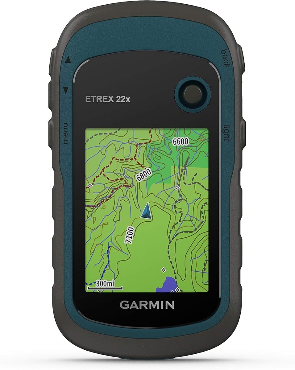
The Garmin eTrex 22x stands as a reliable choice for outdoor navigation with its proven track record and essential features. This model offers a robust build quality that withstands rugged conditions while providing accurate positioning through dual satellite support systems.
We may earn a commission when you buy through this link, at no additional cost to you.
Its preloaded Topo Active maps include routable roads and trails making it easy to plan hiking or cycling routes immediately. The 2.2 inch color display remains visible even in direct sunlight ensuring you can read your path without straining your eyes.
While the screen size is modest compared to modern large-screen devices the physical buttons allow for easy operation with gloves or wet hands. Battery life reaches up to twenty-five hours on two AA batteries which is sufficient for most day trips.
This device is ideal for hikers who prioritize durability and simplicity over advanced smart features. If you need a dependable GPS navigator that works consistently without needing constant recharging the eTrex 22x remains a top recommendation.
By supporting both GPS and GLONASS this device achieves faster signal acquisition and better accuracy in challenging environments like dense forests or deep canyons.
With 8 GB of internal memory plus a microSD card slot you can store extensive map data for multi-day expeditions without running out of space.
We may earn a commission when you buy through this link, at no additional cost to you.
This handheld GPS offers exceptional value for budget-conscious adventurers seeking a rugged navigator with essential features. It includes multi-GNSS support to ensure accurate positioning and comes with preloaded USA Topo maps for immediate use on trails.
We may earn a commission when you buy through this link, at no additional cost to you.
The 3.2 inch screen is large enough to view maps clearly even in bright sunlight while physical buttons provide versatility when wearing gloves. Its IP66 water-resistant design protects against rain and splashes ensuring reliability during wet weather hikes.
Battery life extends up to thirty-six hours on a single charge which is impressive for a rechargeable unit. The ability to recharge via a standard USB-C cable adds convenience when you are traveling or camping without easy access to power outlets.
Ideal for casual hikers or those new to GPS navigation this device balances performance and cost effectively. While it may not have the brand reputation of high-end models it delivers solid functionality for the price.
Supporting GPS GALILEO BEIDOU and QZSS systems allows this device to maintain a strong signal even in areas where one system might be weak or obstructed.
The built-in rechargeable battery eliminates the need to carry spare AA batteries making it easier to keep powered during extended trips.
We may earn a commission when you buy through this link, at no additional cost to you.
The Garmin eTrex Touch combines rugged durability with modern usability through its high-resolution color touchscreen. It offers extensive mapping capabilities including detailed terrain contours and points of interest to enhance your route planning experience.
We may earn a commission when you buy through this link, at no additional cost to you.
Battery life is a standout feature with up to one hundred thirty hours in standard mode and up to six hundred fifty hours in expedition mode. This longevity makes it suitable for long-distance hiking or expedition travel without frequent recharging.
The device supports multi-band GPS for optimal positional accuracy which is critical in dense forests or urban canyons where signal reflection occurs. While the touchscreen is responsive it may require removal of gloves for precise input in cold conditions.
This model is best suited for users who want the convenience of a smartphone-like interface in a durable outdoor package. If battery life and map detail are top priorities the eTrex Touch is a premium choice.
The capability to run for months in expedition mode allows remote travelers to rely on the device throughout multi-month journeys.
Subscribing to Outdoor Maps Plus provides ongoing access to premium map content which you can download directly via Wi-Fi.
We may earn a commission when you buy through this link, at no additional cost to you.
The Garmin eTrex 32x builds on the legacy of its predecessor by adding a 3-axis compass and barometric altimeter. These sensors provide accurate heading data even when you are not moving which is vital for precise navigation in featureless terrain.
We may earn a commission when you buy through this link, at no additional cost to you.
Its barometric altimeter tracks elevation changes allowing you to anticipate climbs and descents along your route. The display remains consistent with previous models offering a sunlight-readable color screen that renders map details clearly.
Battery performance matches the 22x with up to twenty-five hours on standard AA batteries. This standard power source means you can easily find replacements anywhere during your travels without worrying about proprietary chargers.
For hikers who need reliable elevation tracking and compass accuracy without a touchscreen interface the 32x is a strong contender. It strikes a balance between essential sensors and simplicity for outdoor use.
Having a digital compass that works while stationary helps maintain your bearing during stops or when navigating through dense vegetation.
The 8 GB internal memory plus microSD support ensures you can store sufficient map data for regional exploration.
We may earn a commission when you buy through this link, at no additional cost to you.
The S190 Handheld GPS offers an impressive 64 GB of internal memory which is substantial for storing detailed map files. It also features a large 3.2 inch display that is sunlight-readable making it easy to view routes in various lighting conditions.
We may earn a commission when you buy through this link, at no additional cost to you.
This device connects to multiple satellite systems including GPS BeiDou Galileo and QZSS to enhance position accuracy. It comes with preloaded USA Topo maps and a worldwide basemap so you can start hiking right away without extra setup.
Battery life supports long trails with up to thirty-six hours on a full charge. Users should be aware that zooming too far on preloaded maps may cause the screen to go blank so downloading more detailed state maps from the website is recommended.
If you need a device that can hold extensive map data and offers a large screen for easy viewing the S190 is a practical option. Just be prepared to manage map files to maximize its full potential.
With 64 GB you can store detailed maps for multiple regions or even the entire country without needing to delete old files.
Multi-GNSS support ensures that if one satellite constellation is weak the device can rely on others to maintain a lock.
We may earn a commission when you buy through this link, at no additional cost to you.
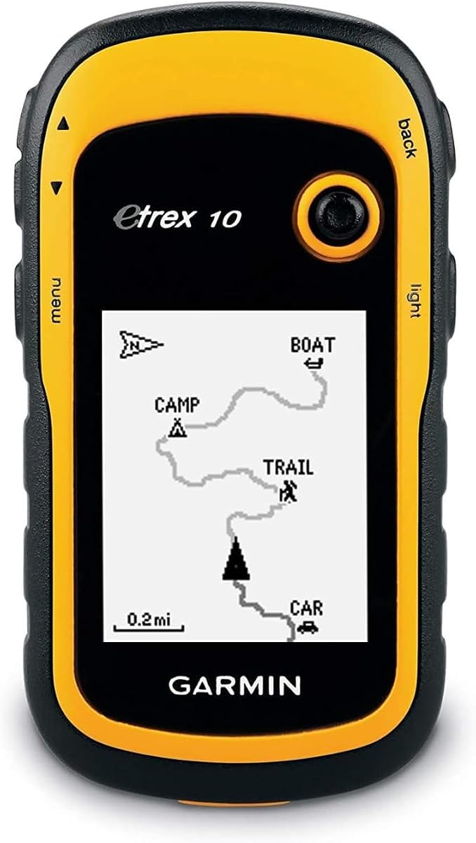
The Garmin eTrex 10 is one of the most compact and lightweight options available for basic navigation needs. It comes with a preloaded worldwide basemap and offers a simple interface that is easy to learn for beginners.
We may earn a commission when you buy through this link, at no additional cost to you.
Its monochrome display is less vibrant than color screens but it consumes less power and remains readable in bright sunlight. WAAS enabled GPS receiver ensures fast positioning and a reliable signal even in challenging environments.
Battery life is robust with up to twenty hours of use on two AA batteries which means you can rely on it for a full day of hiking. It is also waterproof to IPX7 standards so splashes and rain will not harm the unit.
If you prioritize simplicity and weight over color maps this device is an excellent choice for quick trips. It serves well as a backup navigator or for casual walkers who need basic waypoint tracking.
Having a worldwide map preloaded means you can use this unit for travel anywhere without needing to download extra files first.
The device supports paperless geocaching which makes finding hidden caches much easier without carrying paper maps.
We may earn a commission when you buy through this link, at no additional cost to you.
The Garmin Montana 710 offers a generous 5 inch glove-friendly touchscreen that makes viewing maps and interacting with features effortless. Its rugged construction meets MIL-STD 810 standards ensuring it can withstand thermal shock and vibration during tough adventures.
We may earn a commission when you buy through this link, at no additional cost to you.
You can download high-resolution satellite imagery which provides photorealistic overhead views to help you plan routes around landmarks. The device includes built-in ABC sensors which stand for altimeter barometer and compass to give you full environmental awareness.
Memory capacity is expanded to 32 GB allowing you to store additional maps and waypoints for complex expeditions. Battery life reaches up to twenty-four hours in GPS mode which is adequate for most outdoor day trips.
Ideal for users who need a large screen for easy navigation without removing gloves the Montana 710 is a premium handheld. Its durability and large interface make it suitable for professionals and serious enthusiasts.
Downloadable satellite imagery lets you see terrain details that maps alone might miss helping you navigate unfamiliar landscapes.
The combination of barometer altimeter and compass provides comprehensive data on elevation pressure and direction for informed decisions.
We may earn a commission when you buy through this link, at no additional cost to you.
The Garmin eTrex SE is designed for those who prioritize battery life above all else. It delivers up to one hundred sixty-eight hours in standard mode and up to one thousand eight hundred hours in expedition mode on just two AA batteries.
We may earn a commission when you buy through this link, at no additional cost to you.
This model supports multiple global navigation satellite systems including GPS GLONASS Galileo BeiDou and QZSS to ensure accurate tracking even in difficult environments. The 2.2 inch high-resolution display is easy to read even in bright sunlight.
Its water-resistant design rated to IPX7 means it can handle rain and splashes without issues. While it lacks a touchscreen it offers a reliable interface with physical buttons that are easy to operate while wearing gloves.
If you are planning a long wilderness trip where charging is impossible this device is a strong candidate. Its endurance capabilities make it a practical tool for extended outdoor adventures.
In expedition mode the device can last over a year on two batteries by using minimal tracking intervals which is perfect for solo trekkers.
Accessing multiple satellite networks improves accuracy in areas where single systems might struggle such as dense forests or narrow valleys.
We may earn a commission when you buy through this link, at no additional cost to you.
The Garmin GPSMAP 67i distinguishes itself with built-in inReach satellite technology which allows for two-way messaging and location tracking. This feature is invaluable for remote areas where cellular service is completely unavailable.
We may earn a commission when you buy through this link, at no additional cost to you.
You can trigger an interactive SOS to a staffed emergency response coordination center ensuring help can find you quickly. The device also offers access to preloaded TopoActive mapping and satellite imagery to support your navigation needs.
Battery life reaches up to one hundred sixty-five hours in ten-minute tracking mode and up to four hundred twenty-five hours in expedition mode. Multi-band GNSS support provides precise positioning even in challenging terrain or urban canyons.
If safety communication is a priority for your outdoor plans this device offers peace of mind beyond standard navigation. Just note that satellite messaging requires an active subscription plan.
The interactive SOS allows you to communicate with rescue teams to confirm details before help is dispatched increasing safety.
Adjusting tracking intervals lets you extend battery life significantly without losing essential location data.
We may earn a commission when you buy through this link, at no additional cost to you.
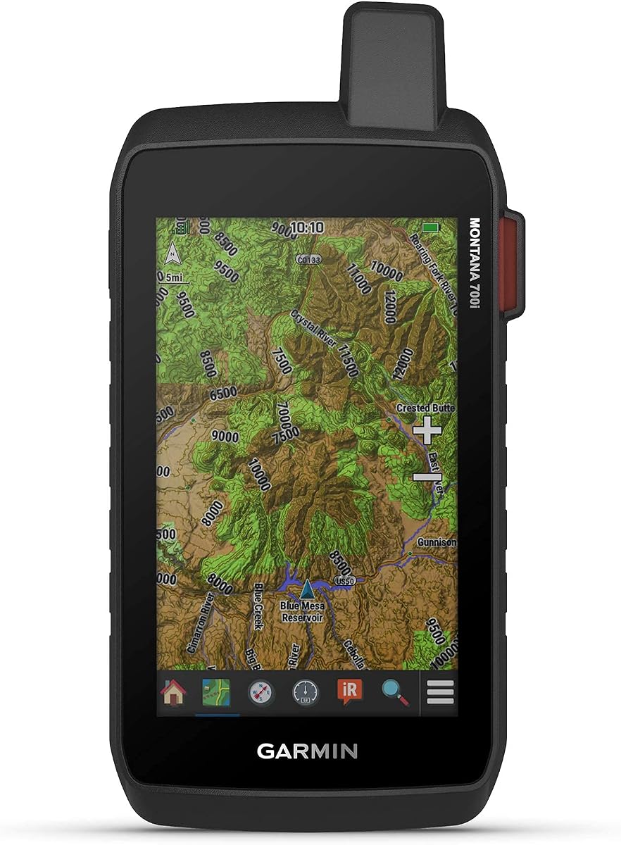
The Garmin Montana 700i brings together a large five-inch glove-friendly touchscreen with built-in satellite technology. It offers easy viewability and versatile mounting solutions making it adaptable for various outdoor activities from hiking to driving.
We may earn a commission when you buy through this link, at no additional cost to you.
Two-way messaging via the global Iridium satellite network keeps you connected even in remote locations. The device supports multi-GNSS navigation and includes sensors like a 3-axis compass and barometric altimeter for accurate positioning.
Connectivity options include ANT+ Wi-Fi and Bluetooth which allow direct access to BirdsEye Satellite Imagery and app support. This networked approach lets you manage waypoints and share locations easily with your team or family.
If you want a comprehensive navigation solution with communication features and a large display this model is a powerful choice. Its rugged build ensures it can handle the elements while providing advanced mapping capabilities.
Wi-Fi and Bluetooth allow you to sync maps and data wirelessly which streamlines trip planning and field updates.
The built-in SOS feature provides an extra layer of safety for solo travelers or those in isolated areas.
We may earn a commission when you buy through this link, at no additional cost to you.
Selecting the right handheld rugged GPS navigator involves balancing screen size battery life mapping capabilities and durability. Understanding these factors will help you find a device that matches your specific outdoor needs.
The display is your primary interface so ensure it is large enough to read comfortably without straining your eyes. Look for sunlight-readable screens that remain visible even in direct bright sunlight which is common on trails.
Prioritize displays that offer high contrast and clear text rendering for map details.
Battery life determines how long you can rely on your device during extended trips. Some units use standard AA batteries which are easy to replace in the field while others use rechargeable internal batteries.
Consider how long you typically hike and whether you need standard cells or a long-life rechargeable system.
Modern GPS navigators often support multiple satellite systems such as GPS GLONASS Galileo and BeiDou to improve accuracy. Multi-GNSS support helps maintain a lock on satellites even in dense forests or urban canyons.
Look for models with multi-band support if you need the highest possible positional accuracy.
Check how much internal memory the device has and whether it supports microSD cards for expansion. Many units come preloaded with base maps but you may need to download detailed topo maps for specific regions.
Ensure the device allows you to load custom maps if you plan to explore less common areas.
A rugged handheld GPS should withstand drops shocks and water exposure. Look for IP ratings such as IPX7 or IP66 which indicate resistance to immersion or dust and water.
MIL-STD 810 certifications also indicate military-grade durability for shock and thermal changes.
Connectivity options like Bluetooth Wi-Fi and ANT+ allow your device to sync with smartphones or other sensors. This integration can help you plan routes on a larger screen and transfer data easily.
Some models also offer satellite messaging which adds a safety communication layer for remote travel.
Advanced models include a 3-axis compass and barometric altimeter which provide heading and elevation data. These sensors help you navigate when stationary and anticipate changes in terrain height.
Having these built-in reduces the need to carry separate instruments on your wrist.
Consider whether you prefer a touchscreen or physical buttons. Touchscreens are intuitive but physical buttons work better with gloves or in wet conditions.
Test the menu system if possible to ensure it is logical and responsive to your inputs.
Before heading into the field ensure your device is fully charged or has fresh batteries installed. Download and install any necessary map updates via Wi-Fi or a computer to guarantee you have the most current data available for your route.
When navigating regularly check your bearing and confirm waypoints match your intended path. Use the track log feature to record your route so you can retrace your steps if needed or analyze your trip later.
Store your device in a protective case when not in use to prevent scratches and damage. Avoid exposing it to extreme temperatures for prolonged periods and keep the screen clean with a soft cloth to maintain readability.
Yes most handheld GPS navigators operate independently using satellite signals so they do not require cellular service. This makes them ideal for remote hiking and camping where network coverage is unavailable. You still need to pre-download maps though to view them offline.
Battery life varies by model and usage mode but many units offer between twenty to thirty hours on standard AA batteries. Some models with rechargeable batteries or expedition modes can last over a hundred hours. Always check specs before a long trip.
Most handheld GPS devices allow you to download detailed topo maps for specific regions. You can often use a microSD card slot or connect the device to a computer to transfer files. Some brands offer subscription map services for premium content.
GPS is the American satellite navigation system while GLONASS is the Russian equivalent. Devices that support both can access more satellites simultaneously improving accuracy and signal reliability especially in challenging terrain. Multi-GNSS support is generally preferable.
Touchscreens can be less responsive with cold hands or when wearing gloves. Physical button models are often more reliable in cold conditions. If you choose a touchscreen look for glove-friendly screens and consider carrying a stylus.
To mark a waypoint you typically press a dedicated mark button while viewing your current location. The device saves the coordinates allowing you to return to that spot later. You can also add notes or names to each waypoint for easier identification.
Choosing a handheld rugged GPS navigator with maps depends on your priorities whether they are battery life screen size or durability. The top picks cover various needs from budget-friendly units to premium models with advanced satellite messaging.
If you value simplicity and reliability look for models with proven sensor suites and easy-to-use interfaces. For long expeditions prioritize devices with long battery life and expandable memory to support your navigation data needs.
Remember to check current prices and model availability before purchasing as features and offers may change. With the right GPS navigator you can explore the outdoors confidently knowing you have a reliable tool to guide your way.